San Francisco Bay-Delta Estuary 2025 Lidar Mapping Collaboration
Description / purpose
This lidar project provides high-resolution, region-wide elevation data for the San Francisco Bay-Delta Estuary, offering an unprecedented view of the landscape, landforms, and habitat conditions. LiDAR, which stands for Light Detection and Ranging, uses laser pulses to measure the distance between the sensor and the ground, creating detailed three-dimensional maps of terrain. This dataset captures fine-scale features across the San Francisco Bay-Delta Estuary. This supports researchers, community members, and agencies to better visualize changes in topography, habitat distribution, and flood risk. By providing consistent, accurate, and comprehensive coverage, the lidar data supports a wide range of applications. Researchers can use the data to study habitat dynamics, track landscape change over time, model ecological processes, and more. Agencies and planners can integrate the information into flood risk management, infrastructure planning, and climate adaptation strategies. Community organizations and local stakeholders can also use the data to understand environmental conditions in their neighborhoods and inform local projects. The lidar data will be made publicly available following final review in 2026.
Availability details and links will be shared here as soon as the data are released.
This lidar collection collaboration would not be possible without funding support from the Wetlands Regional Monitoring Program (through funding awarded by the San Francisco Bay Restoration Authority), Delta Stewardship Council, California Department of Water Resources, South Bay Salt Pond Restoration Project, and Valley Water (Santa Clara County).
Project Details:
|
Area |
~1.25 million acres (the size of Delaware) |
|
Timing |
Coordinated with low tides |
|
Aircraft |
Cessna Caravan |
|
Sensor |
Riegl VQ-1560ii-S |
|
Accuracy |
Precise to ~12 cm (height of a soda can!) |
|
Quality |
Q1 (last LiDAR collection in 2017 was at Q2) |
Linked science activities
None specified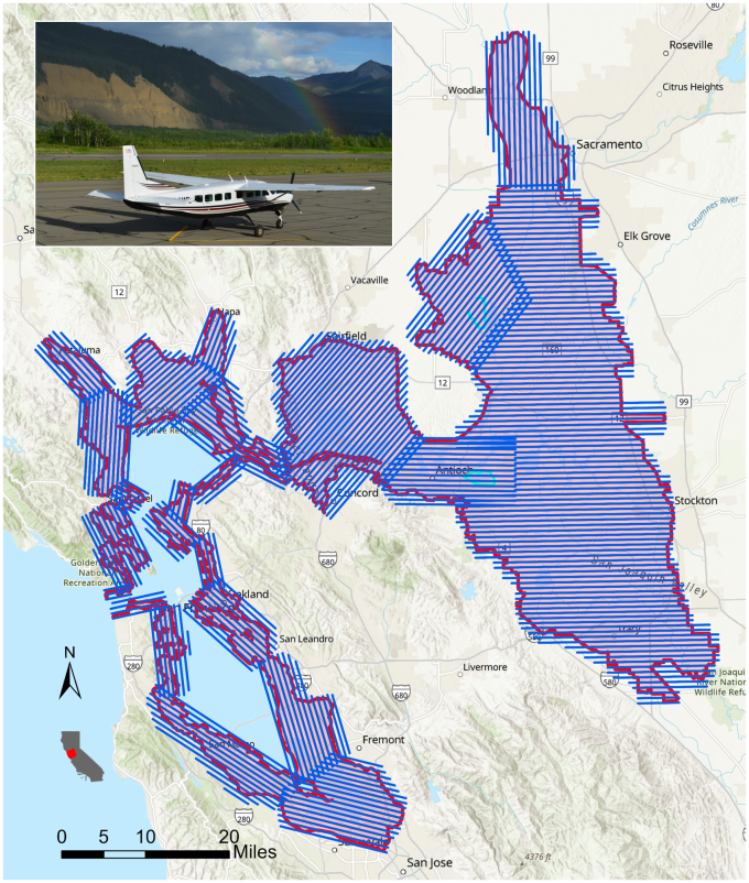
Collaborators
Activity status
- 1 Awarded / Initiating (2025)
- 2 In progress / Ongoing
- 3 Complete
Funding summary
Total allocated funding: $225,000
| Label | Value |
|---|---|
| Contract # or labor code | DSC24966 |
| Implementing organization | NV5 Geospatial |
| Funding organization | Delta Stewardship Council |
| Funding Source | Delta Stewardship Council - General Fund |
| Date of award | 2025-07-11 |
| Date of fiscal year-end | 2025-06-30 |
| Total award amount | $225,000 |
| State type of obligation | Not provided |
| Federal type of obligation | Not provided |
| Reimbursability | Not provided |
| Procurement mechanism | Contracted competitive or direct award |
Location
Geographic tags
Products and outputs
| Type | Title | Description | Views |
|---|---|---|---|
|
|
Capturing the Estuary: New LiDAR Data Collection Underway | Early coverage of the Estuary lidar project, au | 27 |
|
|
DWR's public-facing service 2017 lidar data | DWR's public-facing service 2017 lidar data | 8 |
|
|
A clearer view: The first seamless elevation map of the Bay-Delta | Maven's Notebook web post about the project | 14 |