Water Data Library (WDL) Spatial Data Discovery, Synthesis and Decision Support Tools: Integration of WDL into the Baydeltalive.com
Description / purpose
Managing California’s water supply is complex, requiring careful coordination to ensure sustainability, water quality, and the protection of public and environmental health. In the Sacramento–San Joaquin Bay-Delta, hundreds of datasets from studies and monitoring programs are used to assess conditions and inform key operational decisions. However, these datasets are often fragmented across agencies and stored in inconsistent formats, making it time-consuming for analysts and researchers to locate and use the data effectively.
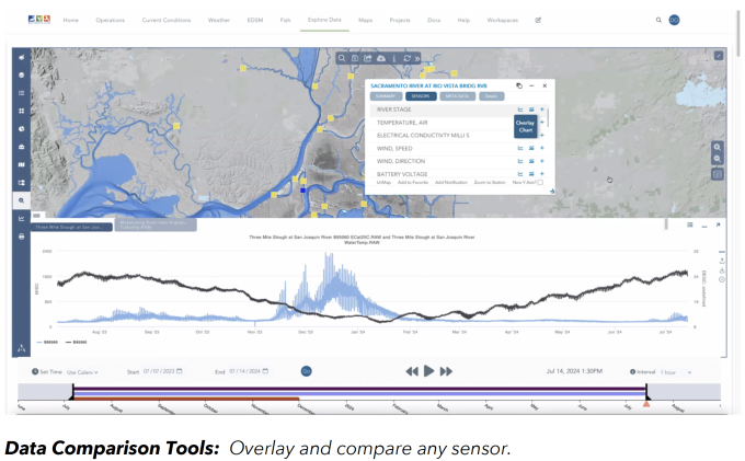
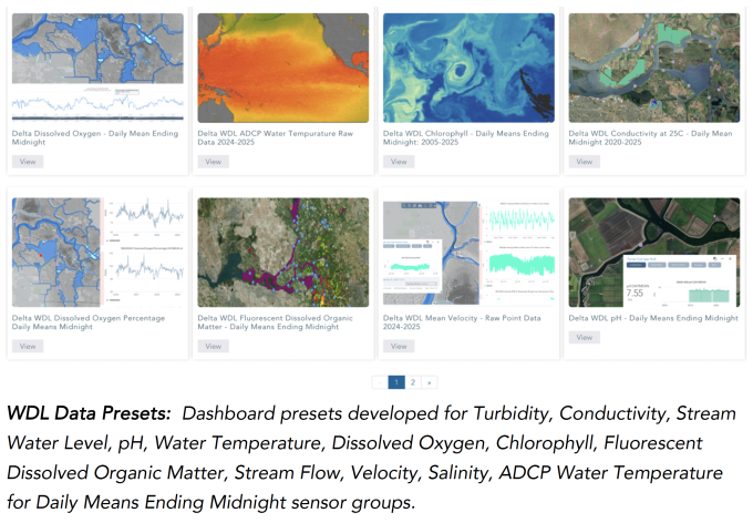
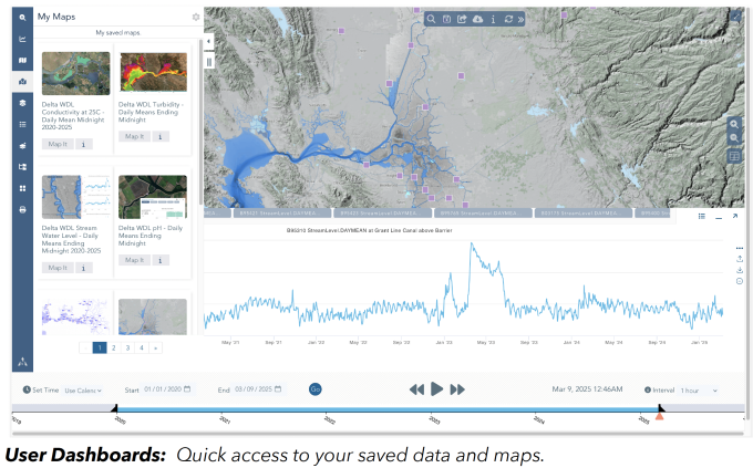
This project aims to enhance the Bay-Delta Live (BDL) data management platform (www.baydeltalive.com) by integrating datasets from the California Department of Water Resources’ Water Data Library (WDL). The primary focus is on water quality and environmental monitoring data. By streamlining access to these resources, the project will improve the discovery, retrieval, and analysis of water-related datasets across multiple sources.
Key outcomes include:
- Unified access to quality-controlled, time-series water data;
- Enhanced spatial visualization and modeling capabilities;
- Improved collaboration among agencies and stakeholders through shared tools and insights.
This work will support more informed decision-making and help ensure the long-term safety, reliability, and ecological integrity of California’s water resources.
Linked science activities
| ID | Title |
|---|---|
| #50169 | Quality Assurance & Quality Control [QA/QC] Program → |


Collaborators
None specifiedActivity status
- 1 Awarded / Initiating (2024)
- 2 In progress / Ongoing
- 3 Complete
Funding summary
Total allocated funding: $0
Products and outputs
None provided