20-mm Survey
Description / purpose
Description
The 20-mm Survey monitors juvenile Delta and Longfin Smelt distribution and abundance throughout their historic spring range in the Sacramento-San Joaquin Delta and upper Estuary.
Project Need
This survey provides up-to-date information specified in the 1995 Delta Smelt Biological Opinion (BO) for the operation of the SWP and the CVP. This survey monitors Delta Smelt around 20 mm TL in size which it is the size that “take” is counted against the SWP and CVP. This information allows managers to vary water operations and provide sufficient flows to maintain Delta Smelt rearing habitat away from the south and central Delta and minimize entrainment. This survey is also a requirement of Section 5.2 of Incidental Take Permit No. 2081-2019-066-003 for the State Water Project, issued by CDFW under the authority of the California Endangered Species Act and pursuant to Fish and Game Code sections 2081(b) and 2081(c), and California Code of Regulations, Title 14. Similar to Delta Smelt, the distribution and catch information of Longfin Smelt are used to determine entrainment risks and ensure that adequate flows are maintained for the protection of young Longfin Smelt.
Project Objectives
- Assess juvenile Delta Smelt and Longfin Smelt entrainment risk at the export facilities based on spatial distribution and relative abundance in the upper San Francisco Estuary.
- Compare current relative Delta Smelt abundance to historical annual abundances (index).
- Provide concurrent zooplankton density and spatial information to monitor the availability of Delta Smelt food supply.
Schedule of Milestones
- Every two weeks between March through July field surveys will be conducted and field and laboratory results will be reported weekly to the Smelt Monitoring Team and the WOMT team starting 5 days after the field sampling is concluded. Shortly afterwards, raw and calculated data will be uploaded to the Region 3’s 20-mm Survey web page.
- A memo describing the annual abundance index will be prepared and distributed in August.
- By the end of the calendar year a draft survey summary article will be submitted to the Editor of the IEP newsletter for publication.
Linked science activities
None specified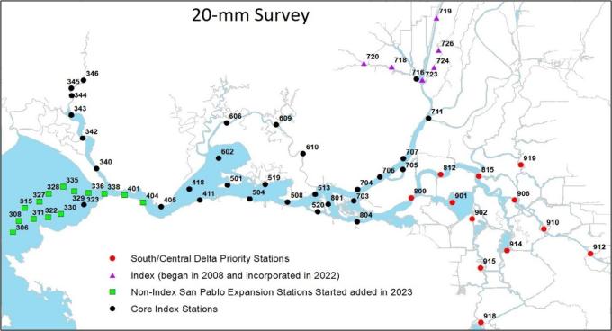
Collaborators
None specifiedActivity status
- 1 Awarded / Initiating (1995)
- 2 In progress / Ongoing (1995 - 2026)
- 3 Complete
Funding summary
Total allocated funding: $0
Location
Geographic tags
Products and outputs
| Type | Title | Description | Views |
|---|---|---|---|
|
|
20-mm Survey IEP Webpage | IEP Website | 1 |
|
|
20-mm Survey Data Management Plan | Data Management Plans (DMPs) are documents that | 3 |
|
|
20-mm Survey IEP Factsheet | Factsheets are concise documents that explain p | 1 |
|
|
Tabular CPUE Fish Results | Fish Distribution Map | 0 |
|
|
20-mm Survey data | Data available at CDFW File Library | 2 |